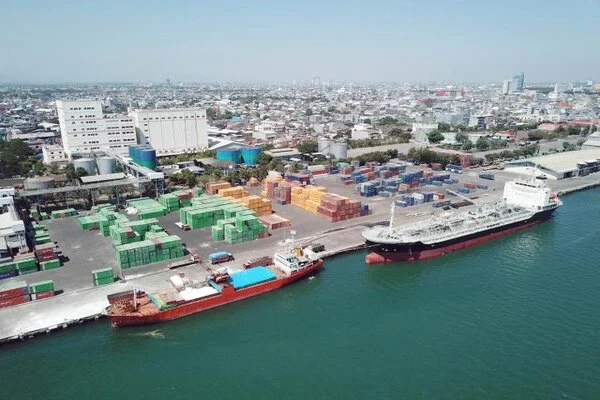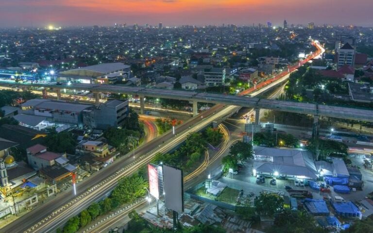

Every building we enter, every bridge we cross, and every road we travel on has one thing in common cement. It is one of the most essential materials for modern civilization, supporting economic growth and infrastructure development around the world. Yet behind its contribution to progress lies an environmental challenge that often goes unnoticed: air pollution. Communities living near cement industries are continuously exposed to airborne pollutants released during quarrying, raw material processing, fuel combustion, and transportation activities. Many of these pollutants are invisible, making them difficult to detect without specialized monitoring equipment. Unfortunately, conventional air quality monitoring stations are expensive to install and maintain, leaving many industrial regions with limited environmental surveillance. This creates an important question: How can we protect public health when we cannot monitor the air everywhere?
This study employed a quantitative research design with a descriptive-comparative approachto evaluate air quality conditions around Cement Industry X in Pangkep Regency. The analysis considered PM10, NO2, SO2 and CO as target pollutants, while the satellite spectral data were usedas predictors for their estimation.
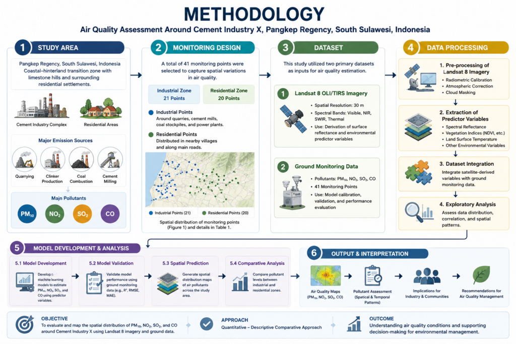
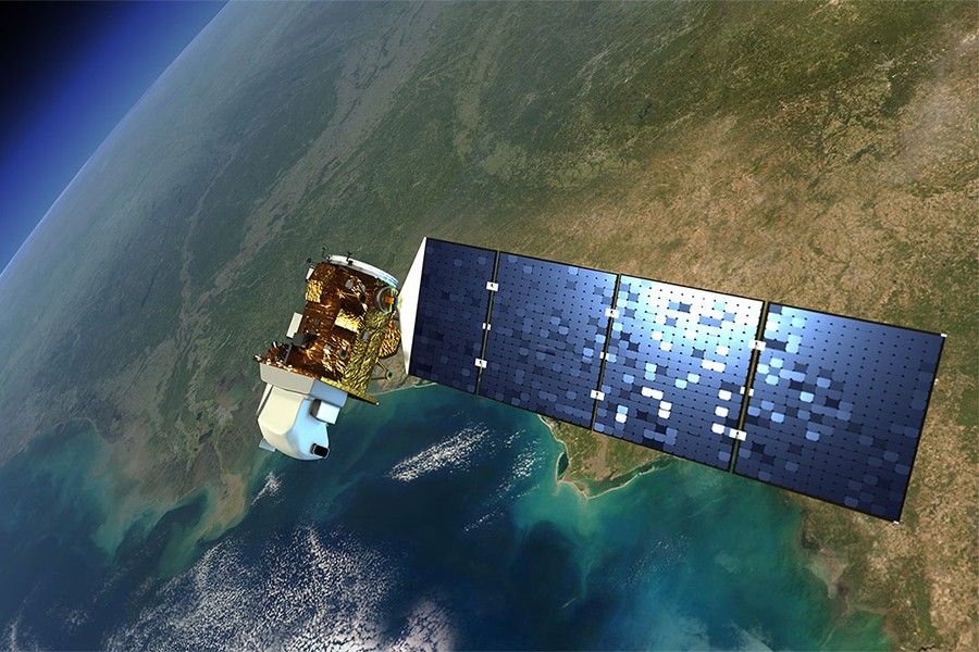
A recent study conducted in a cement industrial area in Pangkep Regency, South Sulawesi, Indonesia, offers an innovative answer. Instead of depending solely on ground-based monitoring stations, researchers combined Landsat 8 satellite imagery with direct field measurements to estimate the concentrations of four major air pollutants: particulate matter (PM₁₀), nitrogen dioxide (NO₂), sulfur dioxide (SO₂), and carbon monoxide (CO). The study evaluated air quality at 41 monitoring locations, covering both industrial facilities and nearby residential communities.
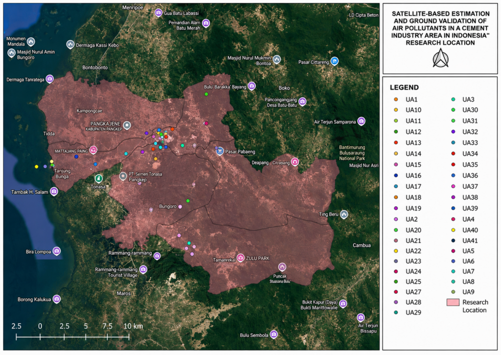
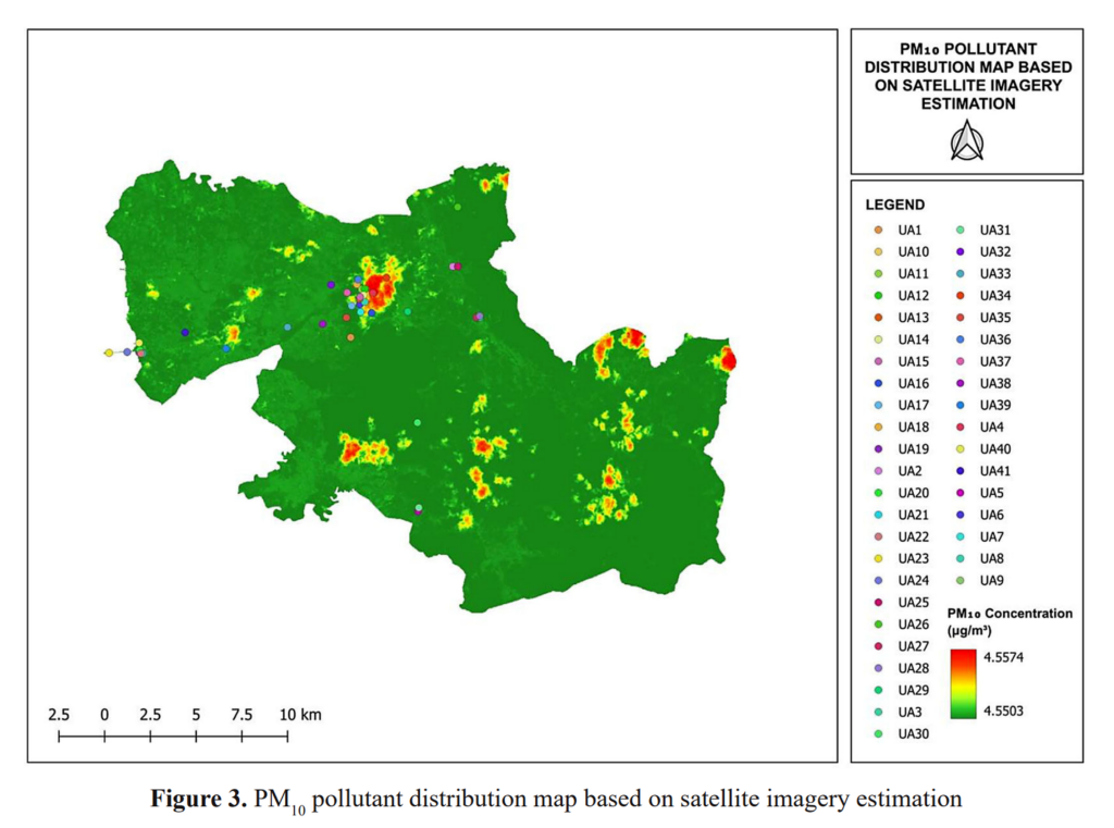
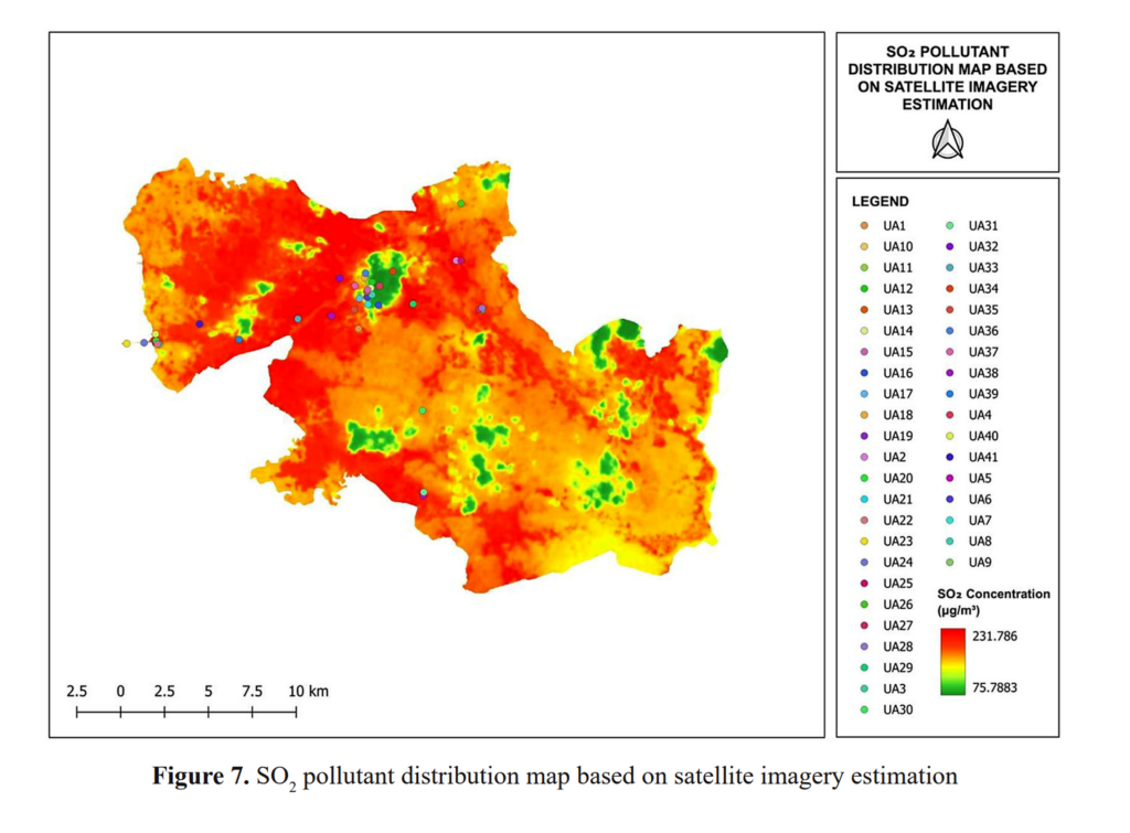
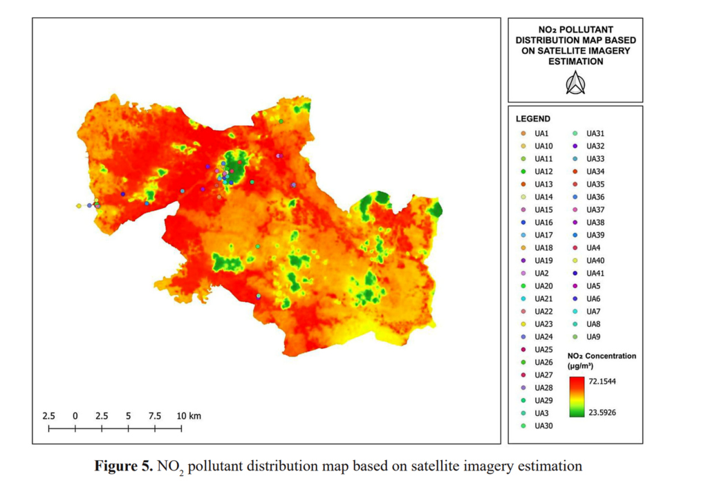
The findings demonstrate that satellite technology can successfully identify pollution hotspots surrounding quarry sites, cement mills, coal stockpiles, and power plants. Areas with intensive industrial operations consistently exhibited higher estimated pollutant concentrations than surrounding locations. These spatial patterns closely reflected the distribution of industrial activities, showing that satellite imagery can effectively reveal where environmental risks are likely to occur.
However, the research also highlights an important scientific lesson: technology is most powerful when different methods complement one another. While satellite observations successfully mapped pollution patterns across a large area, they occasionally overestimated pollutant concentrations compared with direct field measurements. Factors such as atmospheric conditions, land surface characteristics, and the timing of satellite image acquisition influenced the estimation results. Consequently, the researchers concluded that satellite-based monitoring should not replace conventional monitoring systems but instead work alongside them to produce more reliable environmental information.
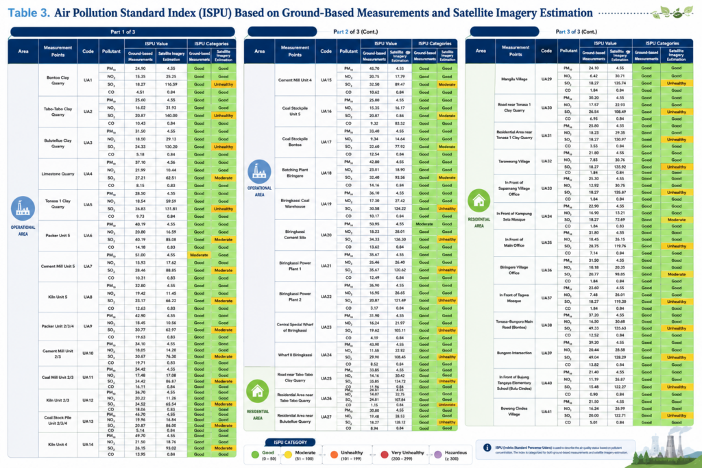
Beyond estimating pollutant concentrations, the study also calculated the Air Quality Index (AQI) and Indonesia’s Air Pollution Standard Index (ISPU). Satellite-based assessments classified several locations as Moderate, Unhealthy for Sensitive Groups, and even Unhealthy, particularly around industrial facilities and nearby residential areas. In contrast, field measurements generally indicated better air quality. Although these differences reveal the current limitations of remote sensing, they also demonstrate its enormous potential as an early-warning system capable of identifying pollution hotspots before environmental conditions worsen.
This research directly contributes to Sustainable Development Goal (SDG) 3: Good Health and Well-being, which emphasizes reducing illness and mortality caused by environmental pollution. Accurate and accessible air quality information enables governments to design evidence-based environmental policies, industries to improve emission control strategies, and communities to become more aware of the quality of the air they breathe. Protecting clean air ultimately means protecting people’s health, productivity, and quality of life.
Looking ahead, satellite technology is poised to become one of the most valuable tools in environmental protection. It offers extensive geographic coverage, rapid data collection, and cost-effective monitoring in areas where conventional monitoring stations remain scarce. As industrial development continues to expand across Indonesia, integrating satellite observations with field measurements will help create smarter environmental management systems, strengthen pollution control policies, and ensure that economic progress is achieved without compromising public health. Sometimes, the best way to safeguard the air around us is by looking at our planet from hundreds of kilometers above it.
Furthermore, this research also supports SDG 17: Partnerships for the Goals. The study demonstrates how collaboration between environmental engineering researchers, satellite technology providers, government agencies, and industrial stakeholders can produce innovative solutions for environmental monitoring. Integrating satellite observations with field measurements not only improves scientific accuracy but also encourages data sharing and evidence-based decision-making. This collaborative approach is essential for addressing complex environmental challenges that cannot be solved by a single institution alone.