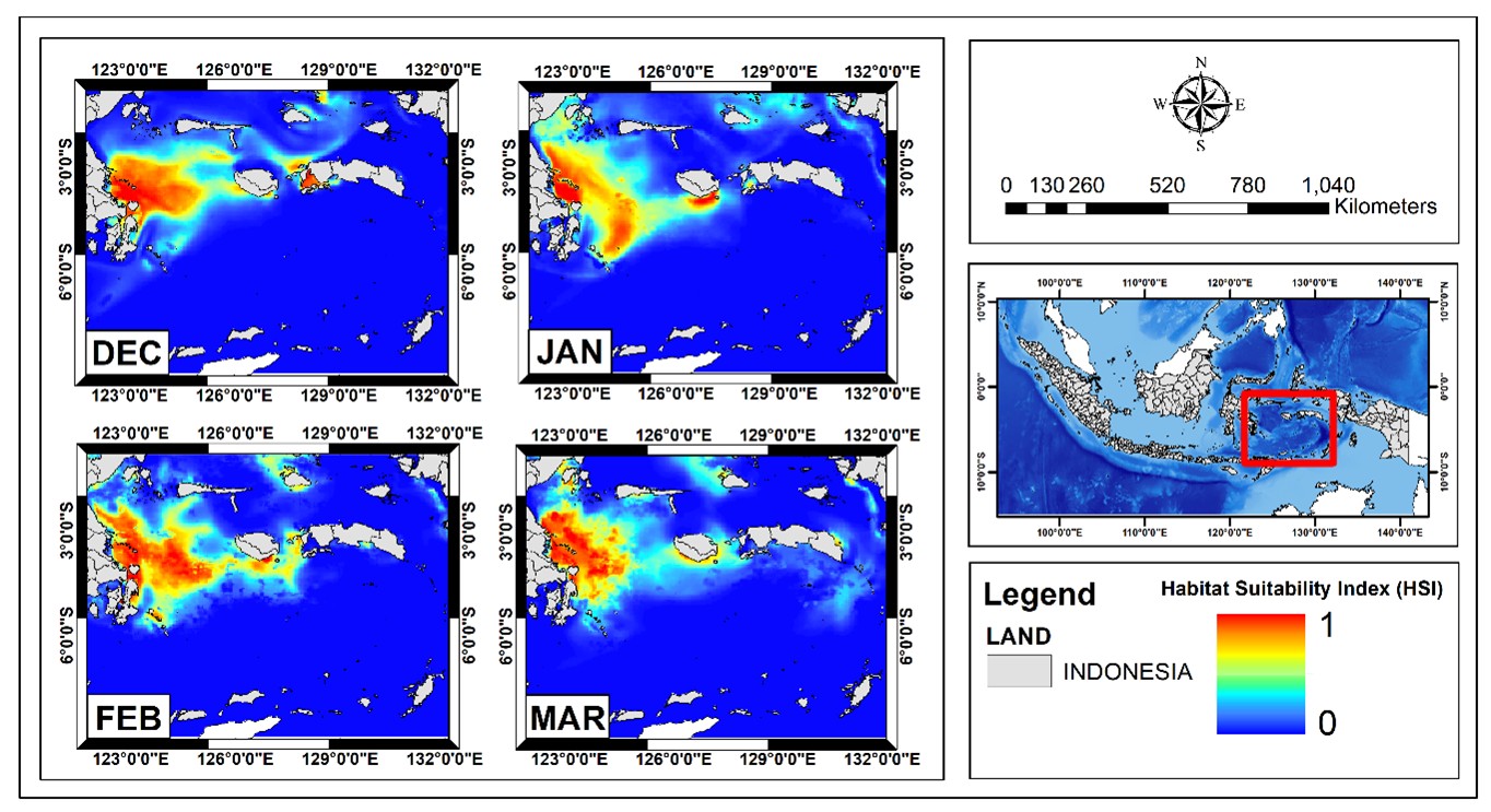

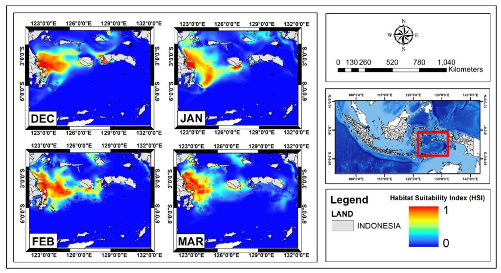
Satellite-based habitat suitability maps reveal seasonal hotspots for Bullet Tuna (Auxis rochei) in the Banda Sea from December to March.
MAKASSAR, Indonesia Aug 29 2026/TRG/ – What if fishers could read the sea before leaving the harbor? In the Banda Sea, one of Indonesia’s most productive waters within the Coral Triangle, researchers are using satellites and geospatial modeling to reveal when and where Bullet Tuna (Auxis rochei) are most likely to gather. The approach could help fishing become more efficient while reducing unnecessary pressure on marine resources.
The study, “Geospatial Modeling of Habitat Suitability and Seasonal Variability of Bullet Tuna (Auxis rochei) in the Central Indonesian Coral Triangle Using Remote Sensing Data,” was published in the International Journal of Engineering and Geosciences. Researchers combined five years of fisheries records from 2018–2022 with satellite-derived sea surface temperature, chlorophyll-a, sea surface salinity, sea surface height, and ocean current data. They then used the Maximum Entropy, or MaxEnt, model to map habitat suitability and the Fishing Season Index to identify the most productive months. Fishing data from 2023 were used to check whether the predictions matched actual fishing locations.
Reading the Ocean’s Hidden Signals
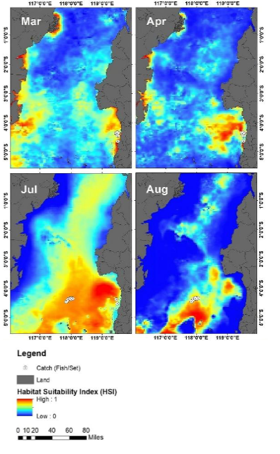
The results show that the sea does not offer the same habitat every month. Bullet Tuna responded most strongly to sea surface salinity and sea surface height. The most suitable conditions occurred at salinity values of about 33.50–34.00 psu and sea surface heights of 0.72–0.74 meters. Suitable habitats were concentrated mainly in the southwestern Banda Sea, especially during the months when environmental conditions supported higher catches.
The seasonal signal was equally clear. December to March emerged as the main fishing season, with March showing the strongest peak. In contrast, May to July represented a leaner period. This information matters because knowing the right time to fish can help reduce fuel use, search time, and economic losses caused by operating when tuna are less available.
From Satellite Maps to Smarter Fisheries
The model performed strongly, with test AUC values of 0.93–0.94, and 2023 fishing locations were largely concentrated in predicted high-suitability areas. This means satellite-based habitat maps could become more than scientific figures: they could support dynamic fishing advisories, seasonal management, marine spatial planning, and real-time monitoring.
For Indonesia, the implications extend beyond catching more fish. Better knowledge of tuna habitat can help balance livelihoods with conservation in one of the world’s most important marine biodiversity regions. The study directly supports SDG 14: Life Below Water by promoting science-based management of fish stocks and marine habitats. It also connects with SDG 1: No Poverty through more efficient fishing livelihoods, SDG 4: Quality Education through the use and sharing of scientific knowledge, and SDG 17: Partnerships for the Goals by emphasizing collaboration among researchers, government institutions, and fishing communities. The original study itself explicitly emphasizes SDG 14 and collaboration for sustainable fisheries.
As ocean conditions become increasingly dynamic, learning to “read” the sea from space may help Indonesia protect its fisheries while keeping coastal economies productive for the future.
DOI:
https://doi.org/10.26833/ijeg.1654590
Contact
Mukti Zainuddin
Corresponding Author
Department of Fisheries, Hasanuddin University
Phone: +62 852-5591-3244
Email: mukti@unhas.ac.id