

In today’s rapidly changing world, protecting natural resources requires more than just observation—it requires smart technology. One fascinating example comes from a scientific study titled “Object-Based Image Analysis for Sago Palm Classification: The Most Important Features from High-Resolution Satellite Imagery,” published in the journal Remote Sensing by MDPI on 20 August 2018 . This research shows how advanced satellite imagery can help us better understand and protect one of Indonesia’s important natural resources: the sago palm.
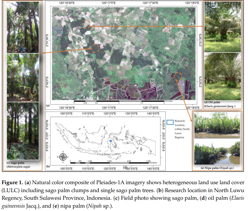
Sago palms are more than just plants. For many communities, especially in eastern Indonesia, they are a vital source of food, income, and cultural identity. However, identifying and monitoring sago palm areas is not easy. Traditional methods, such as field surveys, are time-consuming and expensive. This is where satellite technology becomes a game changer.
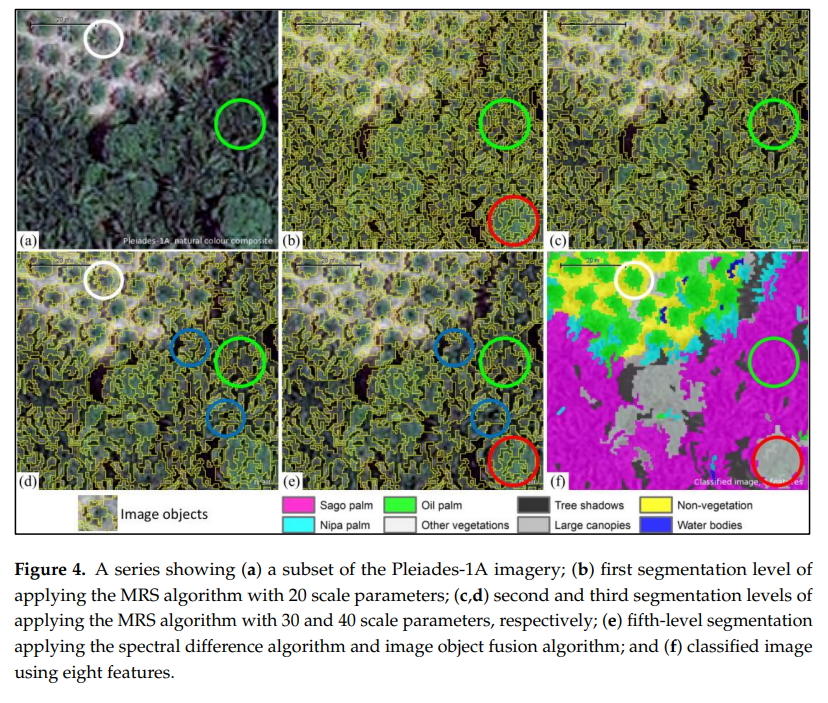
The study introduces a method called Object-Based Image Analysis (OBIA), which uses high-resolution satellite images to classify and identify sago palm trees. Instead of analyzing images pixel by pixel, this method looks at groups of pixels as “objects,” making it easier to detect patterns such as shape, texture, and color. explains that features like texture and vegetation indices are especially important in distinguishing sago palms from other types of vegetation.
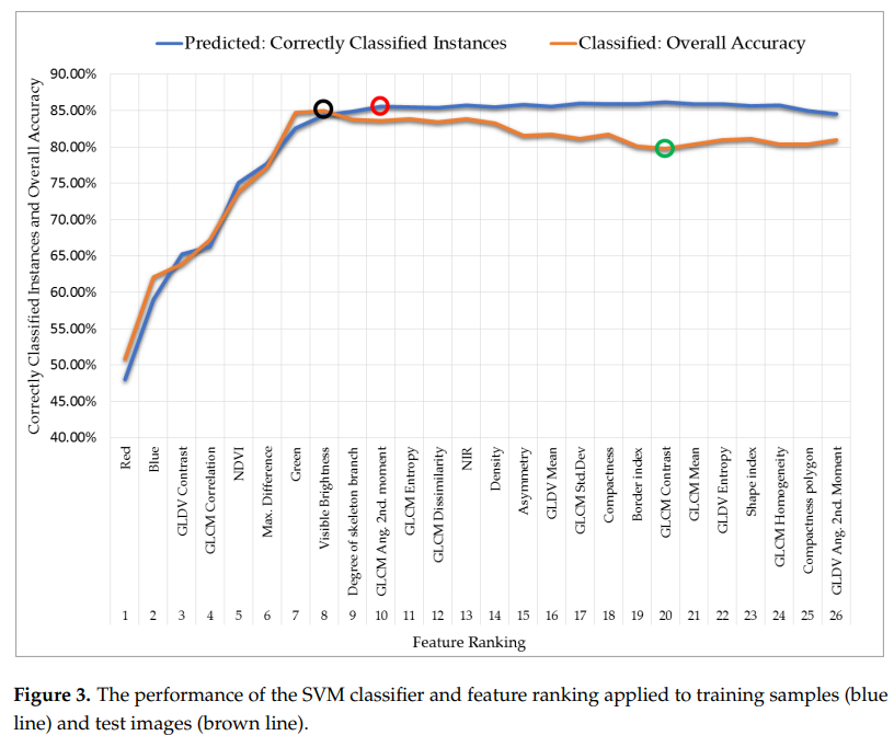
What makes this approach powerful is its accuracy and efficiency. With the help of satellite imagery, researchers can map large areas quickly and monitor changes over time. This is crucial in regions where land use is constantly changing due to urban expansion, agriculture, or environmental pressures.
Why does this matter? Because better data leads to better decisions. When governments and communities know exactly where sago palms are located, they can protect these areas, manage them sustainably, and ensure that future generations can continue to benefit from them.
This research is closely linked to Sustainable Development Goal (SDG) 15: Life on Land. SDG 15 focuses on protecting ecosystems, preventing biodiversity loss, and promoting sustainable land use. By using advanced technology to monitor vegetation, this study supports efforts to conserve important plant species like sago palms and maintain ecological balance.
In addition, this innovation also contributes indirectly to local livelihoods. Sago palms are a reliable food source that can help strengthen food security, especially in rural areas. By protecting these resources, communities can build resilience against economic and environmental challenges.

Another important takeaway from the study is the role of technology in bridging knowledge gaps. With tools like OBIA, even complex environmental data can be translated into practical insights. This makes it easier for policymakers, researchers, and local communities to work together toward sustainable solutions.
In conclusion, the study published in Remote Sensing highlights how combining local knowledge with modern technology can create powerful solutions for environmental management. By “seeing the invisible” through satellite imagery, we can better protect valuable ecosystems like sago palm forests. In a world where natural resources are under increasing pressure, innovations like this offer hope for a more sustainable and balanced future.
doi:10.3390/rs10081319
Contact :
Prof. Agnes Rampisela
metroxylonsagu@trg.unhas.ac.id


