
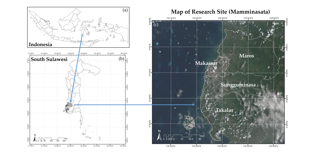

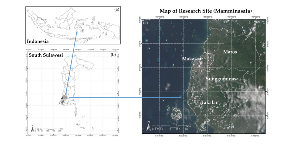
Have you ever wondered how cities grow and what happens to forests, farms, and rivers as urban areas expand? In Indonesia, this question is becoming increasingly important—especially in fast-growing regions like Mamminasata. A scientific study titled “Predicting Land Cover Change in the Mamminasata Area, Indonesia, to Evaluate the Spatial Plan”, published in ISPRS International Journal of Geo-Information by MDPI on 4 August 2020, provides valuable insights into how land is changing—and why it matters for our future .
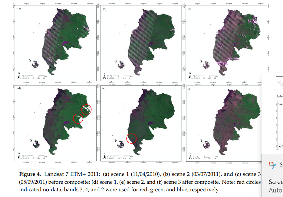
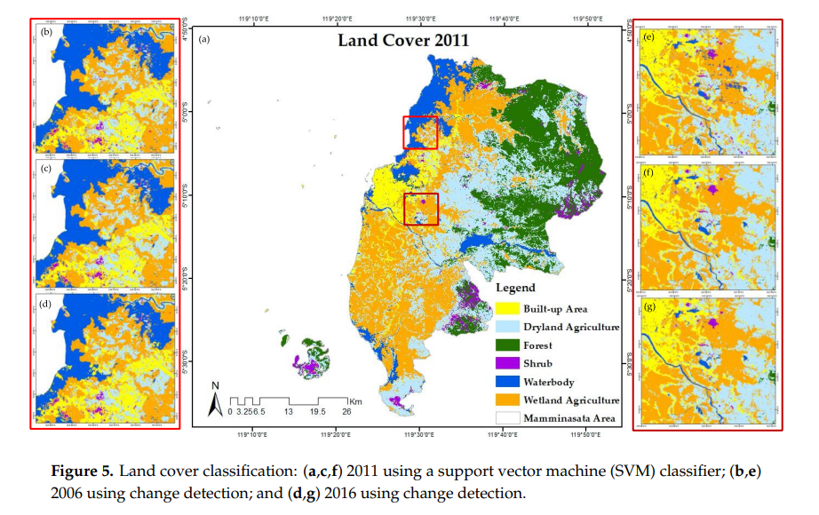
The study focuses on how land use in Mamminasata—covering Makassar and surrounding areas—has changed over time and how it might look in 2031. Using satellite images and advanced computer models, researchers analyzed land cover from 2006, 2011, and 2016. They then predicted future changes using methods like neural networks and the Markov chain. While these techniques may sound complex, the goal is simple: to understand how land is being used and ensure that development remains sustainable.
One key finding is that urban areas are expanding rapidly. Land that was once used for agriculture, wetlands, or even water bodies is increasingly being converted into built-up areas like housing and infrastructure. shows that population growth and proximity to roads and settlements are major drivers of these changes. This trend highlights a critical challenge—balancing development with environmental protection.
Why does this matter? Because land is not just space—it supports ecosystems, food production, and human life. When forests shrink or wetlands disappear, biodiversity is threatened, and communities may lose important resources. The study also found that some protected areas are being used for development, which raises concerns about long-term sustainability.
This issue is closely connected to Sustainable Development Goal (SDG) 15: Life on Land. SDG 15 aims to protect, restore, and promote sustainable use of terrestrial ecosystems. By predicting land cover changes, policymakers can identify risks early and take action to protect forests, reduce land degradation, and preserve biodiversity.
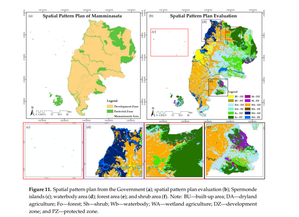
Another important insight from the research is the gap between planning and reality. Although the government has created a spatial plan for 2011–2031, the study reveals that future land changes were not fully considered when the plan was designed . This means that without proper prediction tools, development may not follow the intended path, leading to environmental and social problems.
The good news is that this research offers a solution. By integrating data, technology, and planning, governments can make better decisions. Predictive models allow us to “see the future” and adjust policies before problems become severe.
In conclusion, the Mamminasata case teaches us an important lesson: sustainable development requires not only planning but also accurate prediction. By understanding how land changes over time, we can build cities that grow responsibly while protecting nature. In a rapidly changing world, tools like these are essential to ensure that progress does not come at the cost of our planet.
http://dx.doi.org/10.3390/ijgi9080481
Contact :
Prof. Agnes Rampisela
metroxylonsagu@trg.unhas.ac.id


