MAKASSAR, Indonesia May 22 2026 /GLOHAMOD/– To many visitors, Galesong Beach in South Sulawesi may appear timeless—a stretch of sand shaped by gentle waves and tropical winds. But beneath this peaceful appearance, the coastline is constantly moving. Some areas are growing wider as new sediment accumulates, while others are slowly disappearing under the pressure of erosion. A new scientific study now reveals how these hidden coastal shifts are reshaping one of South Sulawesi’s most important shorelines.
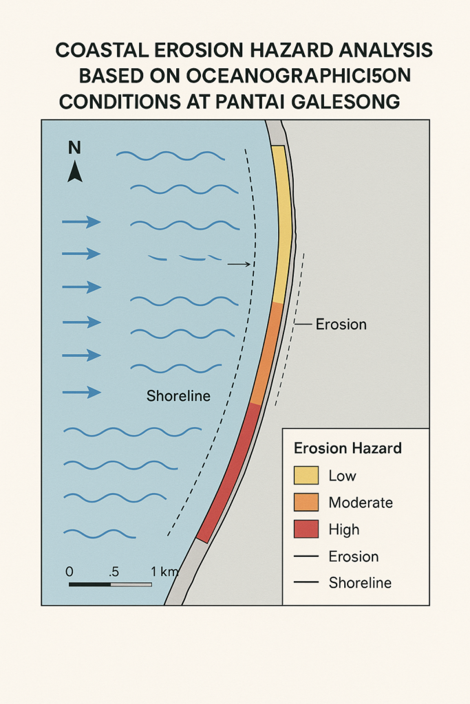
The study, titled Impact of Wave Energy and Sediment Transport on Shoreline Changes: A Multi-Temporal Satellite Image Analysis in Galesong, Takalar Regency, Indonesia, published in the Journal of Degraded and Mining Lands Management by Brawijaya University on July 1, 2025, offers fresh insights into how waves and sediment movement are changing the region’s coast over time.
Using satellite imagery collected between 2010 and 2023, researchers analyzed shoreline movement across seven coastal zones in Galesong. They combined wave prediction models with sediment transport calculations to understand how ocean forces interact with human coastal development and land use.
The results show that wave energy is strongest during the monsoon months of December, January, and February, when wave heights reach between 1.54 and 2.21 meters. These powerful seasonal waves push large amounts of sediment both northward and southward, creating complex patterns of erosion and accretion.
In some areas, especially North Boddia, sediment buildup has extended the shoreline by as much as 141.27 meters, with annual growth rates reaching 10.77 meters per year. Meanwhile, Bontoloe has experienced severe erosion, with parts of the shoreline retreating by up to 43.05 meters and annual losses reaching 3.28 meters.
These changes are more than environmental statistics. They directly affect fishing livelihoods, tourism potential, coastal infrastructure, and community safety.
The findings strongly support SDG 14: Life Below Water, emphasizing the need to protect marine and coastal ecosystems through sustainable shoreline management. Understanding how sediment moves along the coast helps guide smarter conservation strategies that preserve biodiversity and reduce environmental degradation.
The study also contributes to SDG 1: No Poverty, as many local families depend on coastal resources for income. Preventing severe erosion protects homes, fisheries, businesses, and livelihoods that could otherwise be lost to shoreline retreat.
Equally important, the research advances SDG 17: Partnerships for the Goals, highlighting the importance of collaboration between scientists, local governments, engineers, and communities in designing evidence-based coastal solutions.
For Galesong, this research offers a powerful reminder that coastlines are living systems, shaped by both nature and human decisions.
By understanding how waves move sand and reshape the shore, South Sulawesi can build smarter strategies to protect its coastline for future generations—ensuring that the beauty and value of Galesong Beach remain resilient in a changing world.
Reference:
DOI: https://doi.org/10.15243/jdmlm.2025.124.8179
Article Title: Impact of Wave Energy and Sediment Transport on Shoreline Changes: A Multi-Temporal Satellite Image Analysis in Galesong, Takalar Regency, Indonesia
Journal: Journal of Degraded and Mining Lands Management
Publisher: Brawijaya University
Publication Date: July 1, 2025
Contact:
Saaduddin, M. Sc., PhD
+62 8992890320
Saad@sci.unhas.ac.id