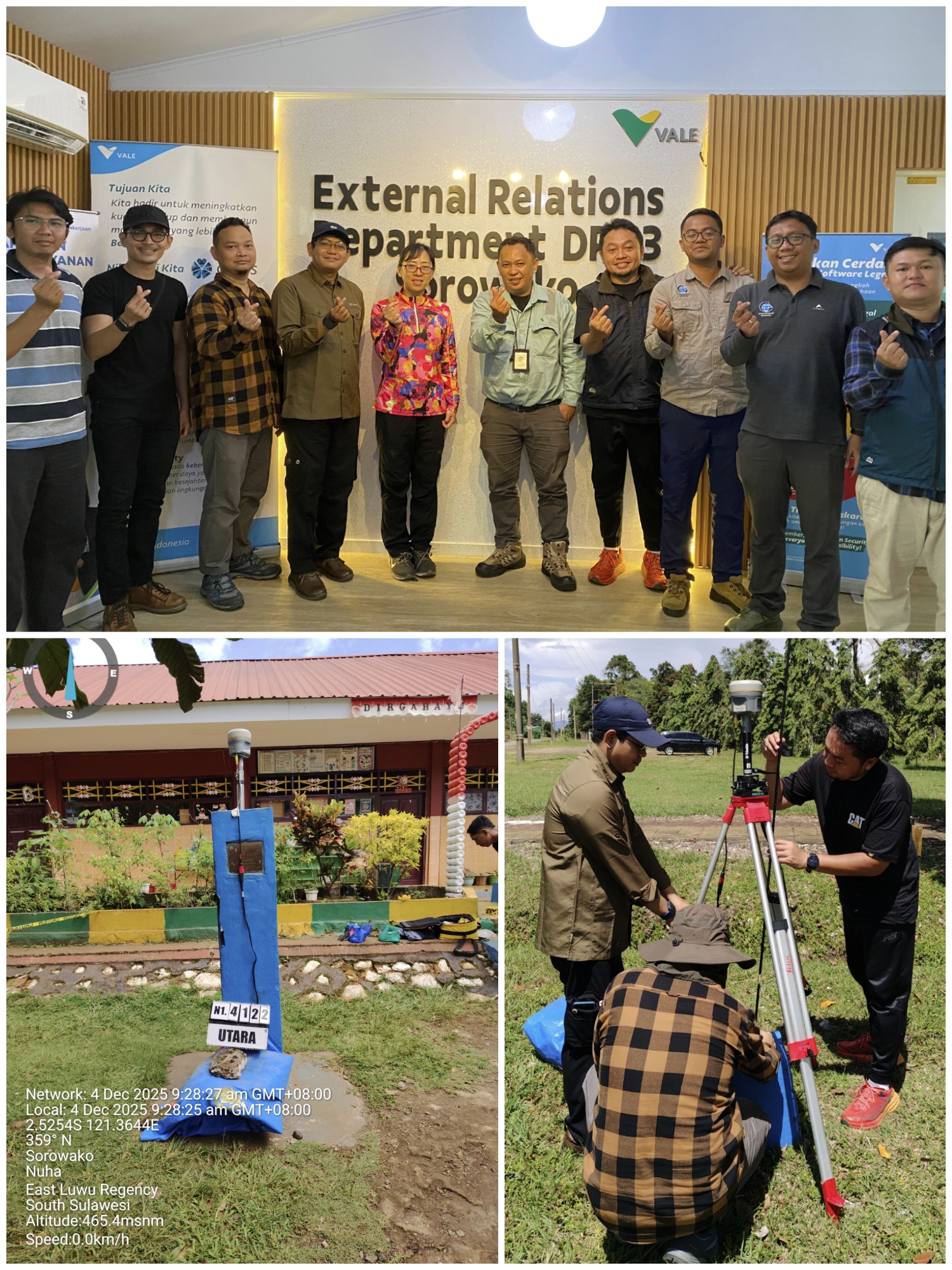

On 27 February 2026, a geodetic GPS survey was successfully conducted in the Matano Fault area, Sorowako, East Luwu Regency, South Sulawesi, Indonesia, as part of a strategic initiative to strengthen the National Geodetic Control Network and support long-term crustal deformation monitoring in active tectonic regions. The activity brought together researchers, technical personnel, students, and industry representatives in a collaborative effort to improve the quality and sustainability of geospatial data for scientific and disaster mitigation purposes.
The Matano Fault is recognized as one of the most significant active fault systems in Sulawesi, with an important influence on regional tectonic dynamics. Due to its seismic potential, continuous geodetic monitoring in this area is essential for understanding crustal deformation patterns and evaluating earthquake-related hazards. Through this survey, the team carried out static GNSS observations at several designated control points distributed along the fault zone to obtain highly accurate geospatial coordinates.
The survey activities involved several technical stages, including monument inspection, instrument setup, precise antenna centering, satellite signal tracking, and long-duration data acquisition. Every observation point was carefully prepared to ensure data reliability and observation stability. By implementing standardized geodetic survey procedures, the team aimed to achieve centimeter-level coordinate accuracy that can support scientific analysis and national geospatial applications.
The collected GNSS data will later be processed and analyzed to monitor crustal movement, evaluate fault displacement, and improve Indonesia’s geospatial reference framework. Accurate geospatial information is highly valuable for many sectors, including infrastructure development, environmental monitoring, land management, and disaster risk reduction. In tectonically active regions such as Sulawesi, continuous deformation monitoring can contribute to better preparedness strategies and help minimize the impacts of future seismic events on local communities.
In addition to its scientific objectives, the activity also served as a platform for knowledge sharing and field-based learning. Participants gained practical experience in operating geodetic instruments, conducting GNSS observations, and understanding the role of geospatial technology in supporting sustainable development. The collaborative atmosphere between academic institutions, government agencies, and the industrial sector also strengthened interdisciplinary communication and encouraged future cooperation in geoscience research.
This activity is closely aligned with several Sustainable Development Goals (SDGs). The survey supports SDG 4: Quality Education by promoting practical scientific learning and technical capacity building in geodesy and geospatial science. It also reflects the values of SDG 17: Partnerships for the Goals, as the program was implemented through collaboration among universities, government institutions, and industry stakeholders. Furthermore, the initiative indirectly contributes to SDG 1: No Poverty, since accurate geospatial information and disaster mitigation planning can reduce economic losses and strengthen community resilience in disaster-prone areas.
Overall, the successful implementation of the geodetic GPS survey along the Matano Fault demonstrates Indonesia’s commitment to strengthening geospatial infrastructure, advancing scientific collaboration, and supporting sustainable disaster mitigation efforts through accurate and reliable geospatial data.