


Description
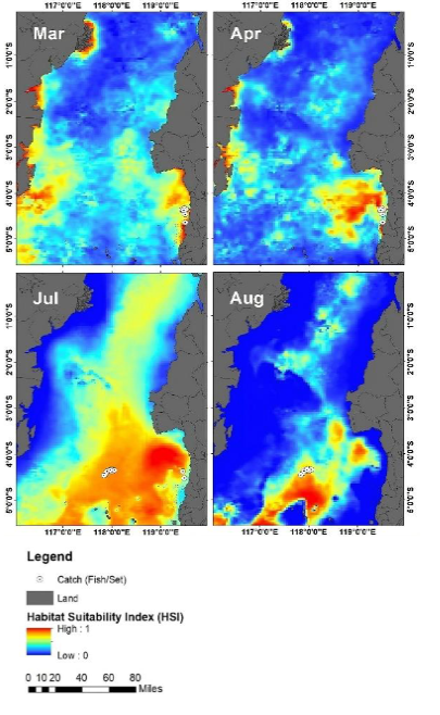
Have you ever imagined that the presence of fish in the ocean could be predicted by reading water temperature, color, and salinity from satellites? For little tuna (Euthynnus affinis), this information can provide important clues about where the most suitable habitats are located, while also helping fishers and fisheries managers understand how ocean conditions change from season to season.
A study conducted by Andi Risda Fitrianti Abudarda, Mukti Zainuddin, Rachmat Hidayat, and Siti Khadijah Srioktoviana from Universitas Hasanuddin explored this question through satellite-based habitat modeling. The study, entitled “Habitat modeling of little tuna (Euthynnus affinis) in Makassar Strait (Indonesia) using MaxEnt,” was published in Biodiversitas, Volume 27, Issue 1, January 2026.
Description
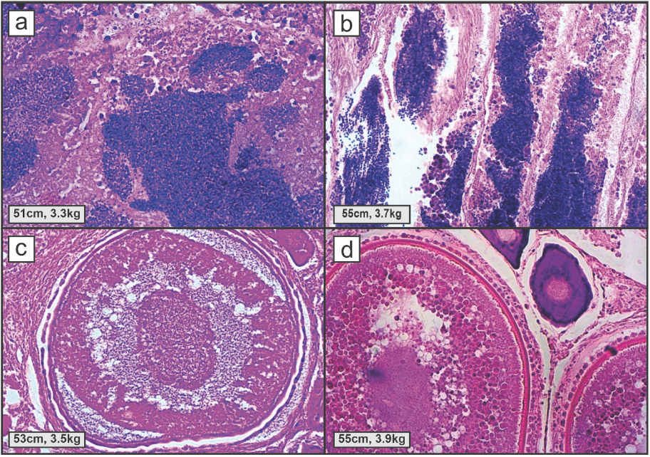
Have we ever wondered what happens when a fish is caught before it has had the chance to reproduce? For skipjack tuna (Katsuwonus pelamis), one of the most important pelagic fish species in Indonesian fisheries, this simple question is closely linked to the future of the stock and the livelihoods of coastal communities that depend on the sea.
A recent study suggests that the answer can be found by looking at two very different sources of information: the reproductive tissues of fish under a microscope and ocean conditions observed from hundreds of kilometers above the Earth. The study, entitled “Identifying local migration and habitat use of reproductive skipjack tuna (Katsuwonus pelamis) in the Bone Bay–Flores Sea, Indonesia,” conducted by Rachmat Hidayat and colleagues, was published in the Egyptian Journal of Aquatic Research, Volume 52, Issue 2, June 2026.
Description
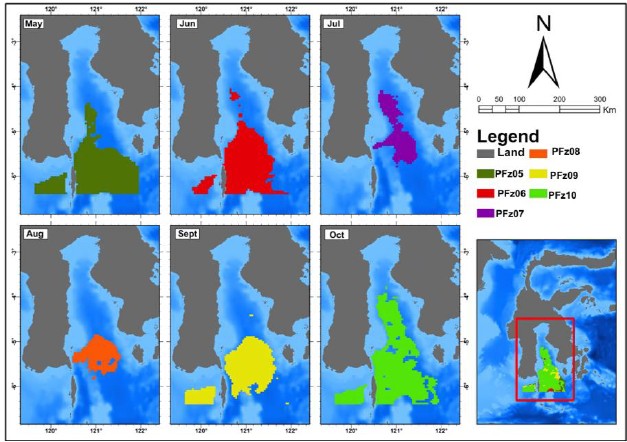
A fishing ground may look empty from the surface, but satellites can reveal where the ocean is creating favorable conditions below. In Bone Gulf, South Sulawesi, researchers have used remote sensing to map potential fishing zones for scad fish (Decapterus ruselli), a small pelagic species that supports coastal livelihoods and contributes to Indonesia’s fisheries economy.
The study combined MODIS-AQUA satellite data on sea surface temperature and chlorophyll-a with actual catch locations. These two oceanographic indicators help describe the environmental conditions that influence where scad fish are likely to gather. Sea surface temperature affects fish metabolism and movement, while chlorophyll-a provides an indication of marine productivity and the availability of food at the base of the food web