



Description
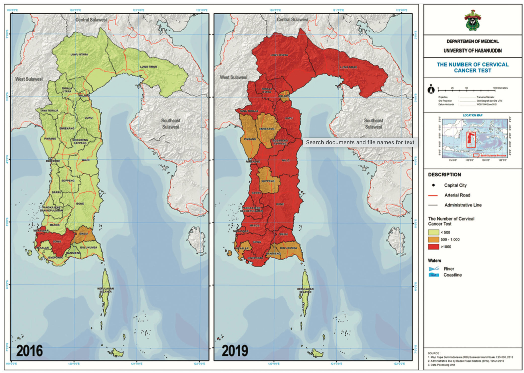
MAKASSAR, Indonesia Feb 03 2025 /STEPMIC/-- That is the powerful idea behind a published study titled “Geospatial Analysis of Cervical Cancer Distribution in South Sulawesi Province,” which appeared in the Open Access Macedonian Journal of Medical Sciences, published by the Open Access Macedonian Journal of Medical Sciences, on 2022 Sep 10. The article shows that cervical cancer is not only a medical issue, but also a spatial one: where people live can shape how easily they access screening, information, and early treatment. The study focused on South Sulawesi and examined screening data from 24 districts and cities between 2016 and 2019. Using geospatial methods such as Global Moran’s I and Local Moran’s I, the researchers mapped patterns of cervical cancer distribution, risk, and clustering. Their analysis found that in 2016 there were several hotspot areas, one cold-spot cluster, and a number of spatial outliers. By 2019, the pattern had improved, but two hotspot clusters still remained, especially in rural areas.

Description
Geospatial Trends and Patterns
By employing Geographic Information Systems (GIS) and spatial epidemiological modeling, the study has mapped CVD prevalence across Indonesia, revealing significant variations between urban and rural areas. The data indicates that high-density urban centers, such as Jakarta, Surabaya, and Medan, have experienced an increasing trend in CVD cases due to factors like high pollution levels, sedentary lifestyles, and high rates of hypertension and diabetes. Conversely, rural regions exhibit lower reported cases but may face challenges related to underreporting and limited access to healthcare services.
Risk Factor Mapping and Hotspot Identification
The analysis incorporates various risk factors, including air pollution levels, dietary habits, economic disparities, healthcare infrastructure, and climate variables.
Temporal Trends and Predictive Modeling
By integrating spatial-temporal analysis and predictive modeling, the study examines how environmental changes, urbanization, and public health policies have influenced CVD trends from 2018 to 2024. The use of machine learning-based spatial interpolation helps project future disease burdens, supporting the development of targeted preventive measures and public health policies.

Description
Description:
STEPMIC is a research group dedicated to advancing knowledge in spatial epidemiology and syndemic theory. By integrating geographic information systems (GIS), spatial analysis, and public health data, STEPMIC investigates the relationships between co-occurring health conditions and their social, environmental, and structural determinants.
Mission:
- Conduct cutting-edge research on spatial patterns of syndemics.
- Utilize GIS and data analytics to explore the intersection of multiple health conditions.
- Provide data-driven insights to inform public health policies.
- Collaborate globally to promote interdisciplinary research on syndemics and health disparities.
Core Values:
- Scientific Excellence:Ensuring rigorous and impactful research.
- Innovation:Applying the latest technologies for spatial and syndemic analysis.
- Collaboration:Building strong networks with academic and community partners.
- Public Impact:Producing research that improves community health outcomes.
Tagline Suggestions:
- Unveiling Patterns, Advancing Public Health
- From Spatial Insights to Health Solutions
- Exploring Spaces, Understanding Syndemics