

MAKASSAR, Indonesia 9 September 2026/SRI-RG/- Rapid urbanization has made Makassar, the capital of South Sulawesi and the largest city on Sulawesi island, one of Indonesia’s fastest-growing metropolitan areas, with its population climbing by roughly 28,460 people over the past decade. Beneath the new malls, housing estates, and expanding roads, however, lies a quieter and less visible danger: mounting evidence that the ground itself is sinking.
But what if satellites orbiting hundreds of kilometers above Earth could catch this invisible shift before it turns into a crisis?
A newly published study offers exactly that kind of early warning. The research, titled “Multi-Temporal Identification and Analysis of Land Surface Deformation with Land Use Land Cover in Makassar City,” was published in the Indonesian Journal of Urban and Environmental Technology on April 2026. The study was conducted by a team from Universitas Hasanuddin, Institut Teknologi Sepuluh Nopember, Universitas Diponegoro, and Omdurman Islamic University.
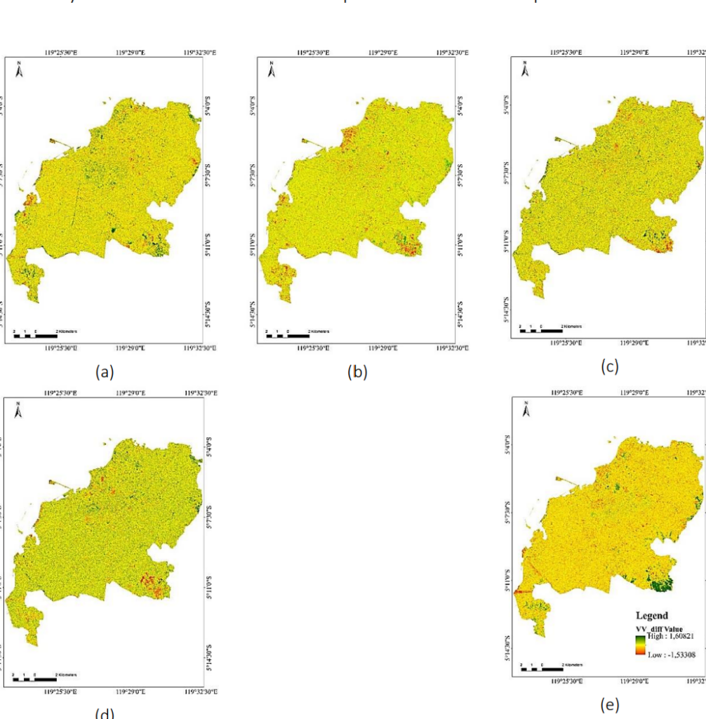
Using five years of satellite radar images (2020-2024) from the European Space Agency’s Sentinel-1 satellite, combined with land-cover maps built from Landsat-8 imagery, the researchers mapped how Makassar’s surface moved over time, and how that movement lines up with the city’s rapid transformation from green space into concrete. Their method relied on comparing “VV backscatter” signals, essentially how radar waves bounce off the same patch of land at different times. A consistently more negative difference often signals subsidence, or sinking ground. Using Google Earth Engine, a free cloud-computing platform, the team processed enormous volumes of satellite data without costly field surveys.
The results paint a clear picture. Built-up areas, meaning buildings, roads, and settlements, showed the strongest and most consistent sinking trend, declining by an average of about 0.0123 dB per year, and in some years over a fifth of built-up land showed signs of significant deformation. Vegetated areas, by contrast, showed a slight positive trend, hinting at natural recovery where green cover remains. The land-classification maps themselves proved highly accurate, with agreement scores (Kappa coefficients) ranging from 0.89 to 0.99, well above the threshold scientists consider reliable.
Why does this matter? As Makassar keeps expanding, heavier buildings, more paved surfaces, and increased groundwater extraction place growing pressure on the soil beneath the city, a pattern already documented in Jakarta, Semarang, Shanghai, and Bangkok. Left unmanaged, this could threaten infrastructure, worsen flooding, and undermine the long-term liveability of a coastal megacity.
This research speaks directly to Sustainable Development Goal 15, Life on Land, which calls for protecting land resources, combating degradation, and restoring balance between human development and ecosystems. By showing where and how fast Makassar’s land is deforming, the study gives city planners a practical, low-cost tool, built entirely from freely available satellite data, to flag vulnerable zones before damage becomes irreversible.
References:
DOI: https://doi.org/10.25105/urbanenvirotech.v9i1.23368
Contact:
Prof. Suherman Hamzah
Emaiml: suharmanhz@unhas.ac.id