Description
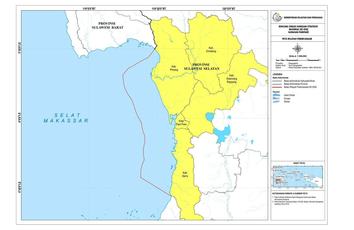
The planning area of the National Strategic Area Zoning Plan (RZ KSN) of KSN Parepare covers 5 (five) regencies/cities in South Sulawesi Province, namely Parepare City, Sidenreng Rappang Regency (Sidrap), Pinrang Regency, Enrekang Regency, and Barru Regency. Of the five regencies/cities included in the KSN Parepare area, only 3 (three) regencies/cities have coastal water areas, namely Parepare City, Pinrang Regency and Barru Regency.
Description
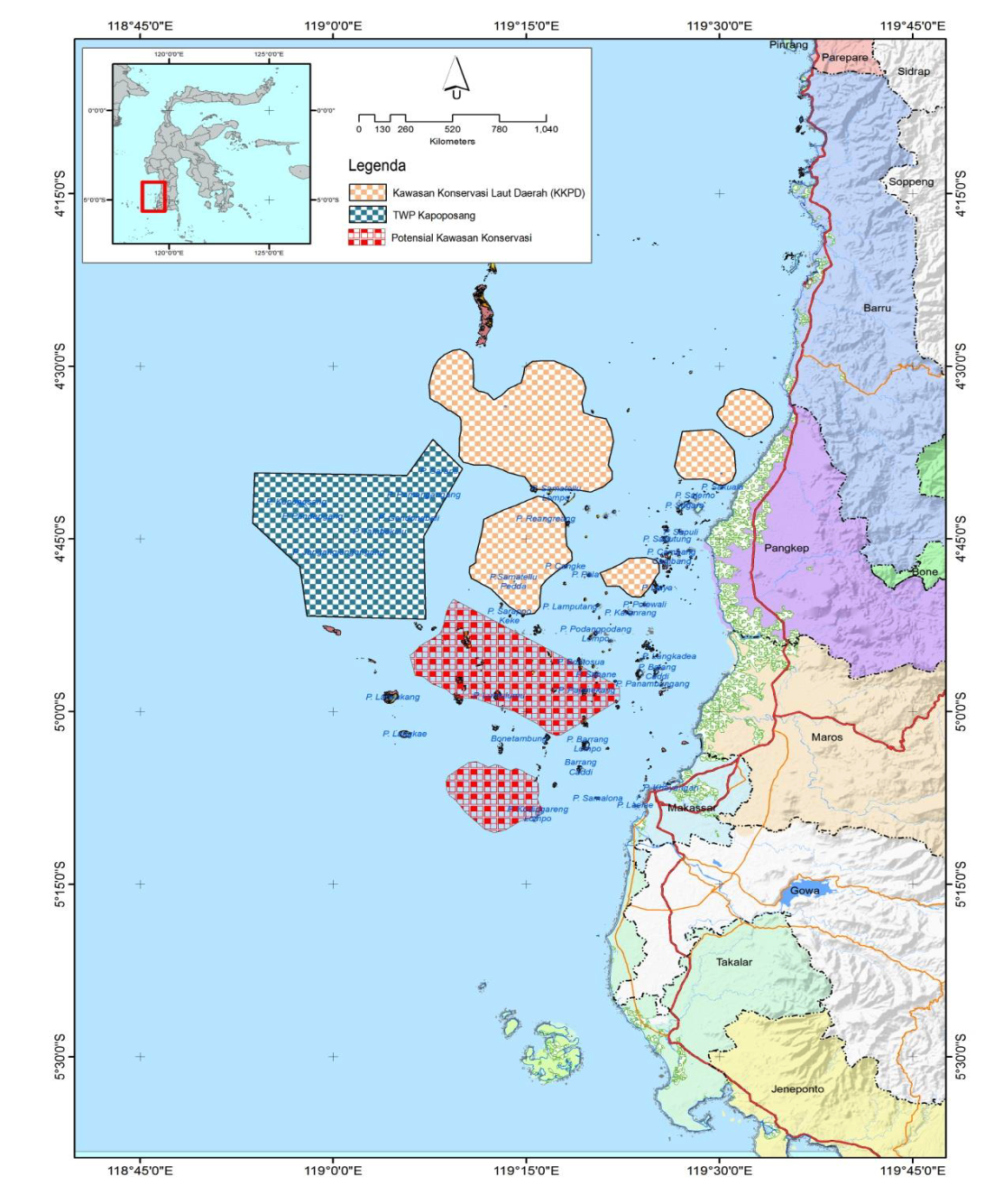
This study was intended to designnetwork of the conservation areas having high resilience to the environmental changes. Method applied in this study was field survey method, analysis of remote sensing images, and integration of geographical information system (decision support) MarxanModel.Results of this study showed that the western coast of South Sulawesi has biophysical relationships caused by oceanographic influence particularly seawater current and highly supporting the development the network of the conservation areas with regional principle. The optimum value for the establishment of the conservation areas was 66553,13 Ha with protection target of 20% from the available ecosystems
Description
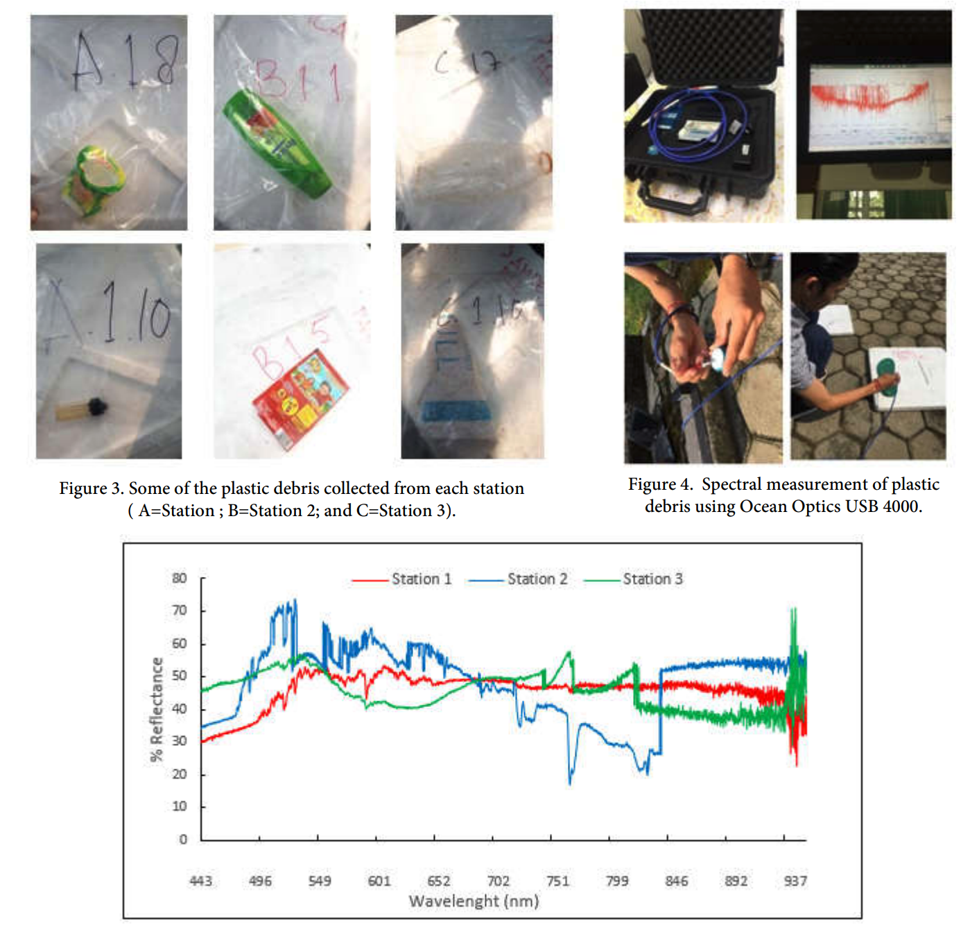
This research was funded by the Ministry of Education and Culture DIKTI on the 2019-2021 National Comptetive Grant SKIM which resulted in several publications including:
1. Abundance and spatial distribution of marine debris on the beach of Takalar Regency, South Sulawesi
2.Spectral characteristics of plastic debris in the beach: Case study of Makassar coastal area
3. Visible reflectance characteristics of marine debris in the sandy beach
Description
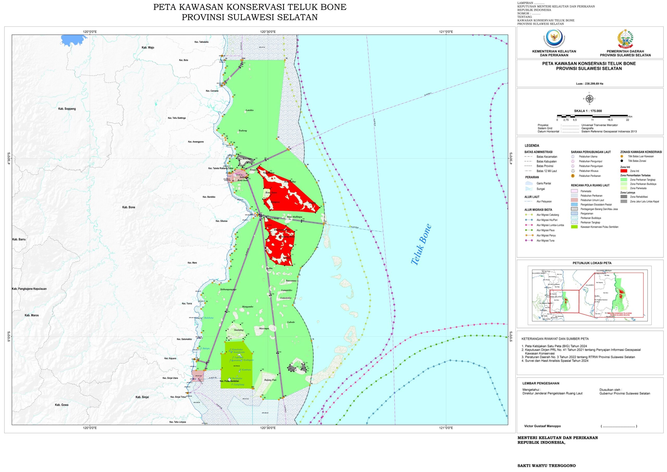
Based on the results of the Marxan analysis, the total area of Bone Bay MPA is 238299.69 ha with the details of each zone in Bone Bay MPA as follows. The area of the core zone is 24172.43 ha or 10.14% of the total area.
The area of the limited use zone is 203891.64 ha, which consists of 3 sub-zones, namely (i) capture fisheries sub-zone (200702.44 ha/84.22%); (ii) aquaculture sub-zone (2448.13 ha/1.03%); (iii) tourism sub-zone (741.07 ha/0.31%).
The area of other zones, according to their designation, is 10235.63 ha, which consists of 2 sub-zones, including rehabilitation sub-zone (1816.73 ha/0.76%) and shipping traffic sub-zone (8418.9 ha/3.53%),
Description
In an effort to protect and conserve the coastal and marine biodiversity of Cermin Island, a protected area is set aside in this area with the management objective to be protecting is the habitat of coastal and mangrove ecosystems and complementing the coastal and marine conservation efforts in Cermin Island MPA, a management plan will be prepared, which is a necessity in the management of water areas and in accordance with existing regulations.
This management plan is expected to provide direction and guidance to the management body to effectively manage the Mirror Island MPA.
Based on the results of the analysis of the plan to establish Cermin Island MPA as a protected area, the following conclusions can be drawn:
1) The results of the analysis and scoring that have been obtained for the category of conservation areas in the Cermin Island MPA is Small Island Park (TPK).
2) Conservation targets in the waters of Cermin Island MPA are mangrove ecosystems, proboscis monkeys and crab spawning grounds.
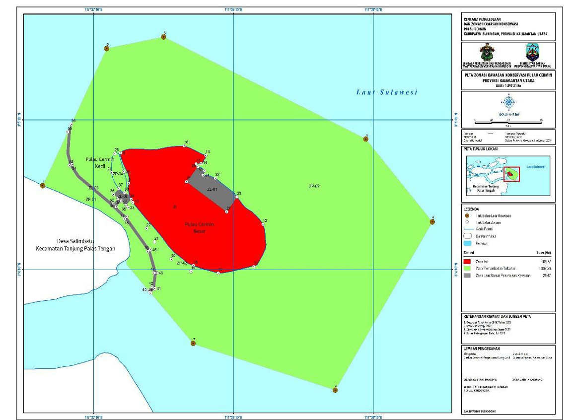
3) Based on the results of the Marxan analysis, the total area of Cermin Island MPA is 1295.54 ha with details of each zone in Cermin Island MPA as follows:
- The area of the core zone is 169.77 ha or 13.10% of the total area. Meanwhile, if based on Permen KP 31 where the park category must have at least 10% of the habitat area, then Cermin Island MPA has met the intended criteria.
Description
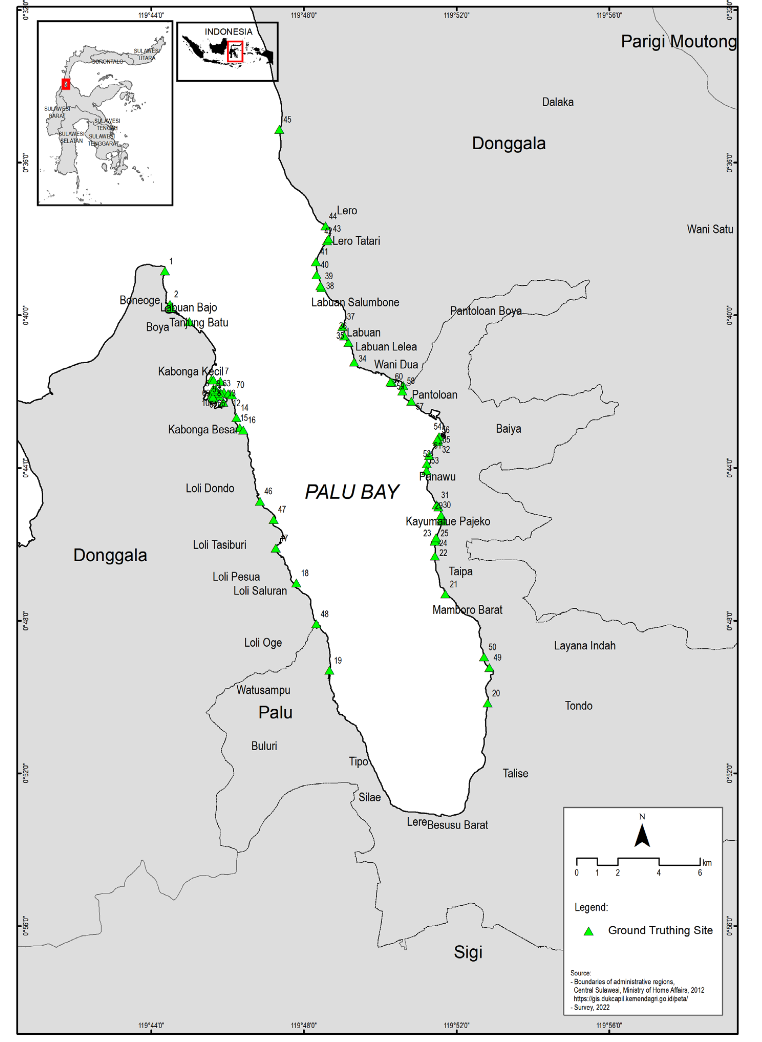
Seagrass meadows provide a variety of material, non-material and regulatory coastal ecosystem service; however, as the distribution of seagrass beds changes over time due to both anthropogenic activities and natural factors, it is important to monitor changes in seagrass condition. Seagrass meadows in Palu Bay are threatened by activities such as coastal development and land reclamation. Additionally, the bay was hit by a significant tsunami in 2018, which could have impacted ecosystems in the bay, including seagrass meadows. The aim of this study was to detect changes in seagrass extent and distribution over a 10-year period from 2012 to 2022 and changes in land use over approximately a decade (2010 and 2021) through the use of remote sensing technology. Changes in eagrass meadow areal extent were analyzed using data from a 2012 Landsat 7 Satellite Data Acquisition and a 2022 Landsat 8 Satellite Data Acquisition. Water column correction was implemented using the Lyzenga Algorithm. The results showed a significant decrease in the area of seagrass meadows around the coastal area of Palu Bay. Seagrass meadows in 2012 and 2022 covered 127.08 Ha and 87.79 Ha, respectively, indicating a decrease in extent of 43.29 Ha. As the accuracy of the satellite data classification results was 80%, the results are considered acceptable. Anthropogenic activities (mainly mining and construction related) are strongly suspected as the main drivers of this decline, while earthquake and tsunami events likely aggravated the degradation of coastal ecosystems in Palu Bay, including seagrass meadows.
Description
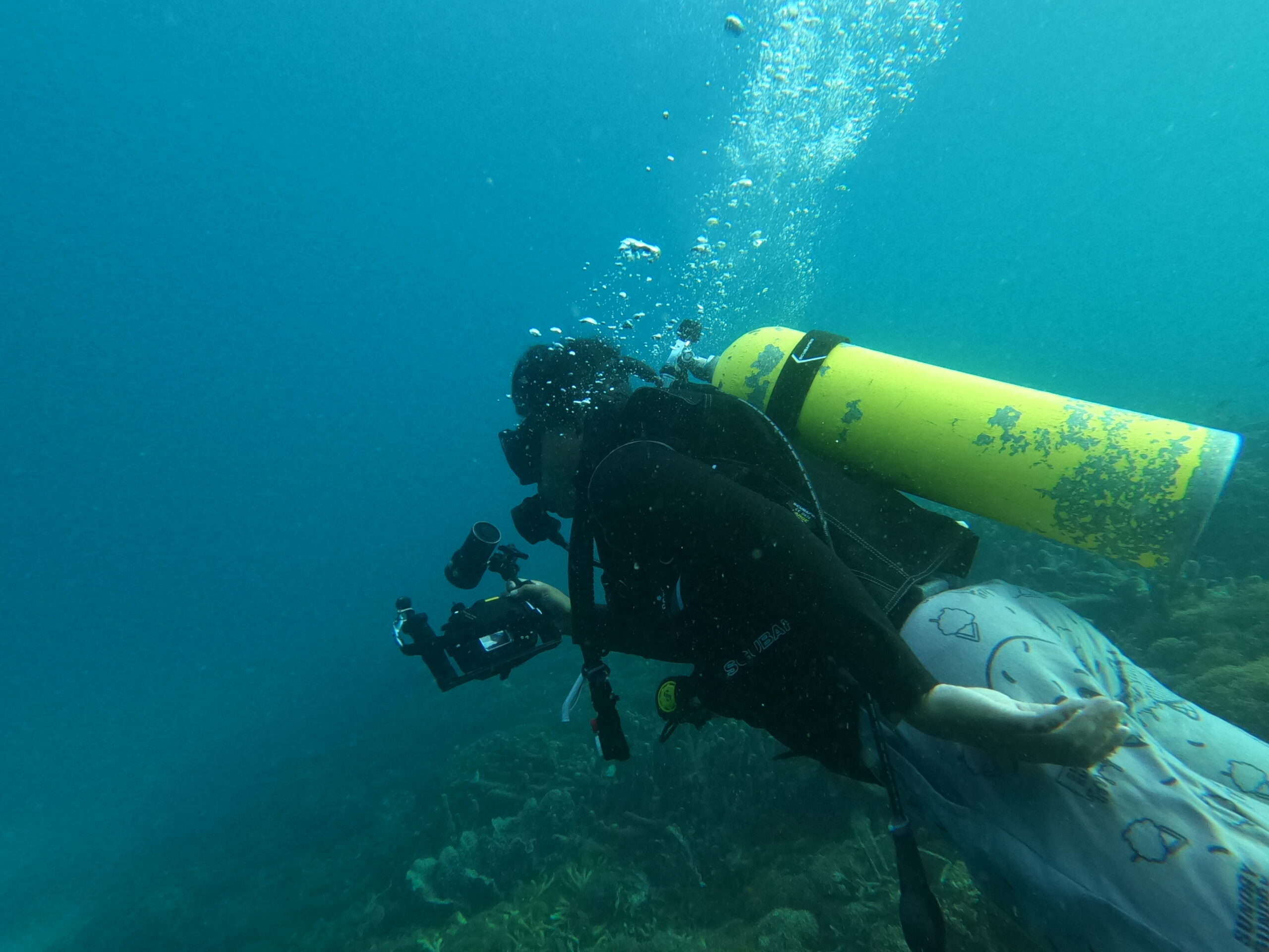
Turtle protection is carried out through the transplantation of coral and seagrass located on Salissingan Island in the Balabalakang Archipelago, Mamuju, West Sulawesi. This activity is funded by the MBZ Foundation as a form of environmental concern.