
MAKASSAR, Indonesia Mar 27 2026/Resource Economics Research Group/ – Why do some regions grow rapidly while others remain left behind—even when they share similar resources? This question becomes even more complex in countries like Indonesia, where geography is fragmented and development is uneven. A recent study titled “Spatial Spillovers in Regional Economic Inequality: Evidence from Macro Indicators—Remote Sensing in Eastern Indonesia,” published in the journal Economies by the Multidisciplinary Digital Publishing Institute (MDPI) on March 27, 2026, offers a new way of understanding this issue—by literally looking at inequality from space.
Instead of relying solely on traditional economic data, the study combines spatial econometric analysis with satellite-based indicators. These include data on economic activity, urbanization, and even energy potential captured through remote sensing technology. By doing so, the research moves beyond conventional approaches and reveals patterns of inequality that are often invisible in standard statistics.
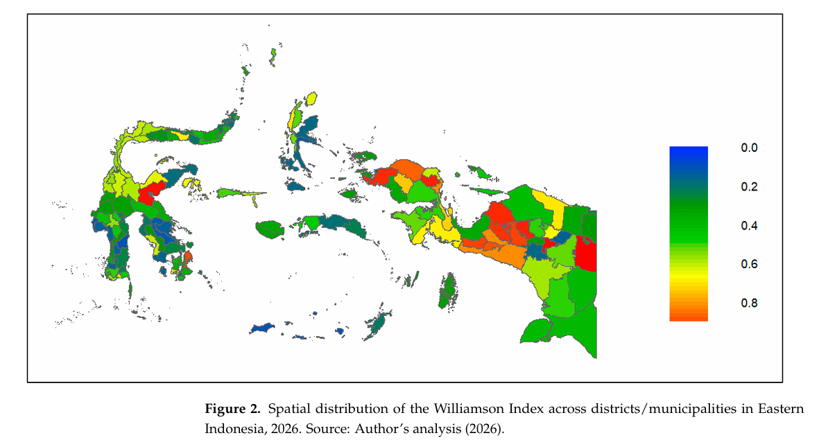
One of the most important findings is that regional inequality does not occur in isolation. It is shaped by what economists call spatial spillovers—meaning that what happens in one region can directly affect neighboring areas. The study shows clear clustering of inequality in Eastern Indonesia, where some districts experience concentrated growth while others lag behind. This suggests that development is not evenly distributed, but instead follows spatial patterns influenced by connectivity, infrastructure, and local dynamics.
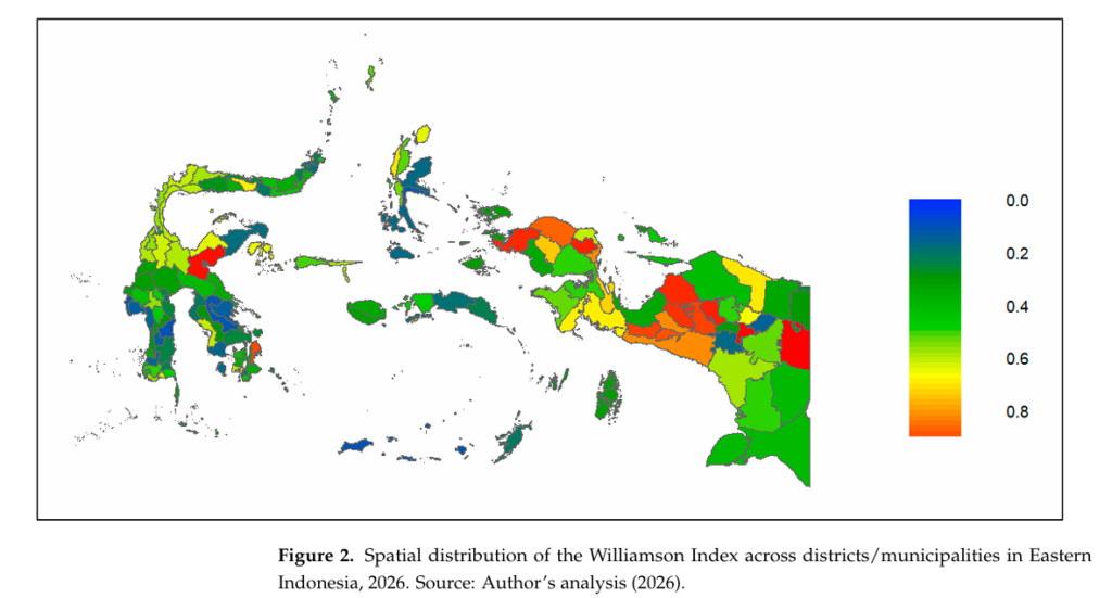
Interestingly, the study finds that natural resource potential alone does not explain these disparities. Regions rich in resources do not automatically achieve higher levels of development. Instead, factors such as how economic activities are distributed and how urbanization spreads play a more significant role. Areas with more evenly dispersed economic activity tend to experience more balanced development outcomes.
These insights are highly relevant to global development priorities, especially SDG 1: No Poverty, SDG 4: Quality Education, and SDG 17: Partnerships for the Goals. The connection to SDG 1 is particularly strong. Persistent regional inequality can trap certain areas in cycles of poverty, limiting access to opportunities and basic services. By identifying where and why these inequalities occur, policymakers can design more targeted interventions to reduce poverty.
Meanwhile, SDG 4 highlights the importance of education in addressing regional disparities. Unequal access to quality education often mirrors spatial inequality, with remote or underdeveloped regions facing greater challenges. Understanding spatial patterns of inequality can help governments allocate educational resources more effectively, ensuring that no region is left behind.
Equally important is SDG 17, which emphasizes collaboration. Tackling regional inequality requires coordinated efforts across different levels of government, as well as partnerships with researchers and technology providers. The use of satellite data in this study is a clear example of how innovation and collaboration can enhance policy analysis and decision-making.
Ultimately, the study delivers a powerful message: to solve regional inequality, we must first understand its spatial nature. Development policies cannot be one-size-fits-all—they must be tailored to specific places, taking into account local conditions and regional interactions.
By combining advanced data analysis with cutting-edge technology, this research opens a new frontier in understanding economic inequality. And perhaps most importantly, it reminds us that sometimes, the best way to see the full picture is to look at it from above.
Reference
DOI: https://doi.org/10.3390/economies14040109
Contact:
Hamrullah
+62 812-4244-186
hamrullah@fe.unhas.ac.id