Makassar, Indonesia/May 21, 2026/PRG/Earthquakes cannot be predicted with precision, nor can they be prevented. Yet the destruction they leave behind is never purely a product of geological forces alone — it is equally a consequence of what we choose to build, where we choose to settle, and how well we prepare. In Takalar Regency, a fast-growing coastal district in South Sulawesi, a 2025 research study is offering a scientifically grounded foundation for making those choices more wisely.
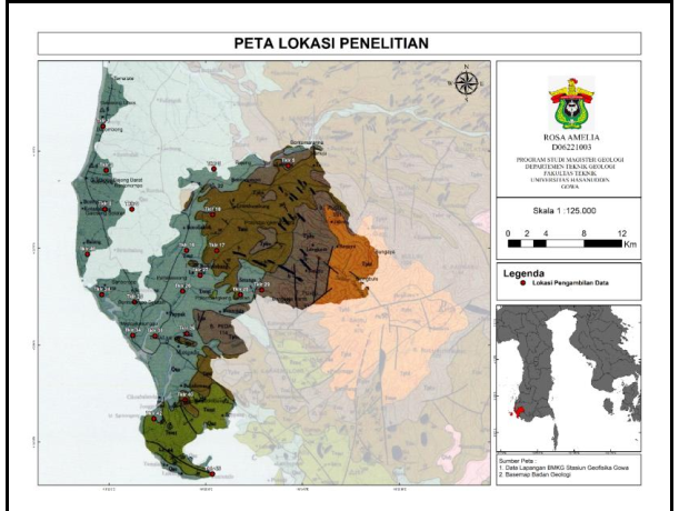
The study employs the Horizontal to Vertical Spectral Ratio (HVSR) microtremor method — a geophysical technique that captures imperceptibly faint natural ground vibrations to characterize subsurface soil conditions. By analyzing how these ambient signals behave across different locations, researchers can determine the thickness and softness of sediment layers, both of which govern how intensely seismic waves are amplified during an earthquake. The findings are striking: large portions of Takalar, particularly its coastal districts, are underlain by soft, thick sedimentary deposits highly prone to seismic amplification. Districts such as Galesong, South Galesong, North Galesong, and Sanrobone were identified as zones of elevated vulnerability — places where ground shaking during a seismic event could significantly exceed what the earthquake’s raw energy would otherwise produce, placing homes, schools, roads, and critical infrastructure at serious risk.
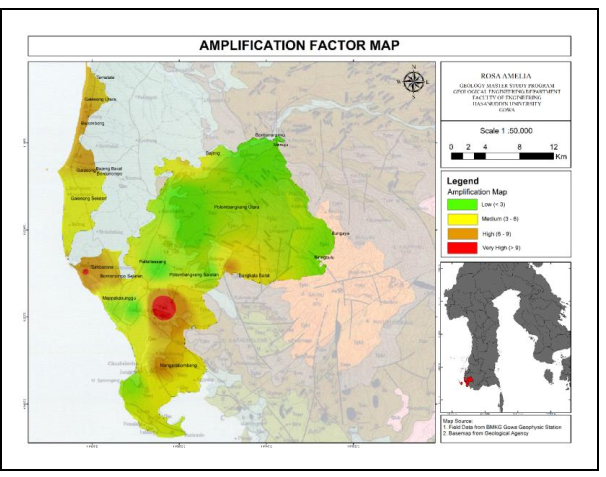
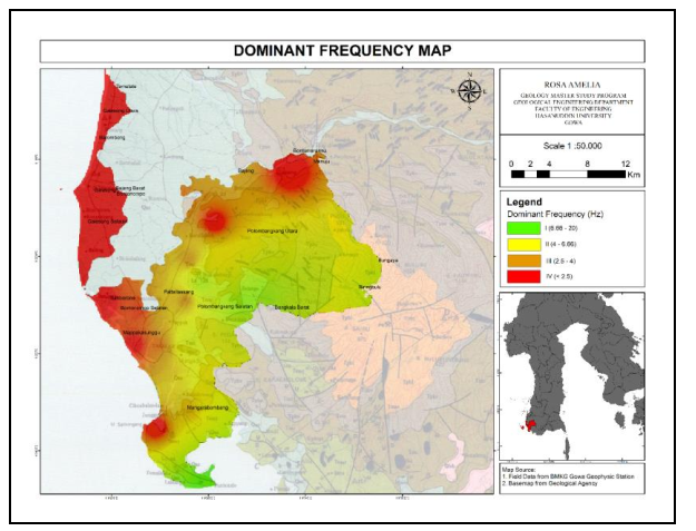
The study supports SDG 1: No Poverty. Natural disasters often affect poor communities the most because they have limited access to strong housing, emergency resources, and financial recovery systems. By identifying high-risk zones earlier, governments can create better disaster mitigation plans that protect vulnerable communities from economic losses caused by earthquakes.
Building Informed Communities — SDG 4: Quality Education. Scientific data of this kind only fulfills its potential when it reaches beyond academic journals. Integrating seismic vulnerability findings into school curricula, university geoscience programs, and community disaster preparedness initiatives transforms technical knowledge into practical resilience. When students, teachers, and local residents understand why certain soils behave the way they do during earthquakes — and what that means for their own neighborhoods — they are far better equipped to respond effectively when disaster strikes.
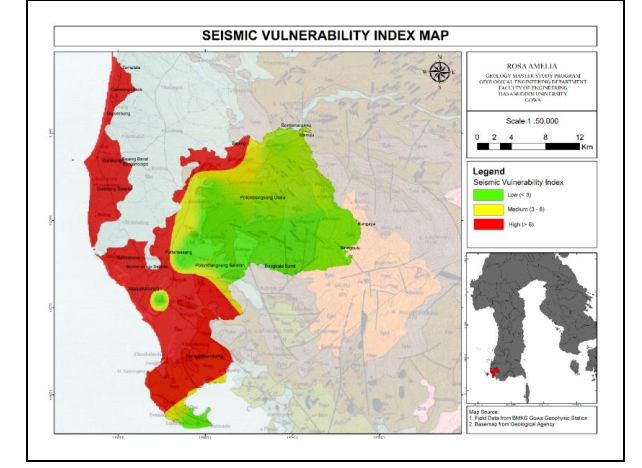
In addition, the research contributes to SDG 15: Life on Land. Earthquakes do not only damage buildings; they disrupt land surfaces, destabilize agricultural soils, and degrade coastal ecosystems that communities depend upon for food security and livelihoods. Geology-informed spatial planning — determining which areas are suitable for development and which should be preserved as buffer zones — reduces both human exposure and ecological harm, supporting more sustainable land use over the long term.
SDG 17: Partnerships for the Goals. The research exemplifies the collaborative model that effective disaster science demands, bringing together university researchers and institutions such as BMKG in a shared pursuit of public safety. When academia, government agencies, and policymakers operate in genuine partnership, scientific findings are far more likely to translate into enforceable building codes, revised land-use plans, and community action — turning knowledge into protection.
Reference:
DOI: 10.1088/1755-1315/1451/1/012042
Contact Person:
A.M. Imran | +62 812 4291 5528 | imran-am@eng.unhas.ac.id