


ROADMAP
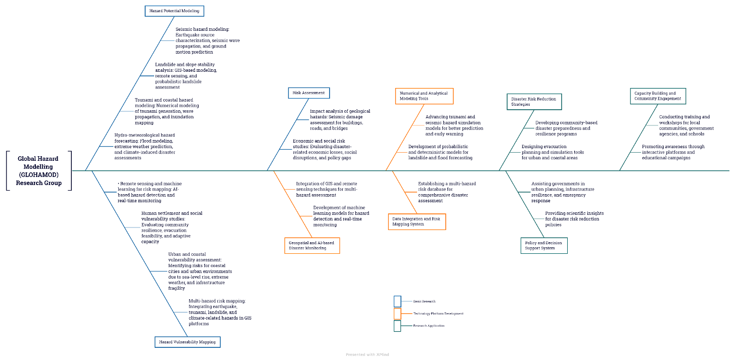
Research Sub-Theme
Hazard Potential Modeling
Utilizing advanced simulations and predictive models to assess disaster risks.
Key Research Areas:
- Seismic Hazard Modeling → Earthquake source characterization, seismic wave propagation, and ground motion prediction.
- Tsunami and Coastal Hazard Modeling → Numerical modeling of tsunami generation, wave propagation, and inundation mapping.
- Landslide and Slope Stability Analysis → GIS-based modeling, remote sensing, and probabilistic landslide assessment.
- Hydro-meteorological Hazard Forecasting → Flood modeling, extreme weather prediction, and climate-induced disaster assessments.
Hazard Vulnerability Mapping
Identifying and visualizing at-risk areas through geospatial analysis.
Key Research Areas:
- Multi-Hazard Risk Mapping → Integrating earthquake, tsunami, landslide, and climate-related hazards in GIS platforms.
- Urban and Coastal Vulnerability Assessment → Identifying risks for coastal cities and urban environments due to sea-level rise, extreme weather, and infrastructure fragility.
- Human Settlement and Social Vulnerability Studies → Evaluating community resilience, evacuation feasibility, and adaptive capacity.
- Remote Sensing and Machine Learning for Risk Mapping → AI-based hazard detection and real-time monitoring.
Risk Assessment
Evaluating the impact of potential disasters on communities, infrastructure, and the environment.
Key Research Areas:
- Impact Analysis of Geological Hazards → Seismic damage assessment for buildings, roads, and bridges.
- Economic and Social Risk Studies → Evaluating disaster-related economic losses, social disruptions, and policy gaps.
Disaster Risk Reduction
Promoting awareness and preparedness through community engagement and capacity-building programs.
Key Research Areas:
- Disaster Awareness and Preparedness Training → Conducting workshops for local communities, government officials, and schools.
- Evacuation Planning and Simulation → Developing emergency response protocols for urban and coastal areas.